What's New

What's New or Updated

Multiple Pages link added to top of Results Pane

KGIS Maps

A small enhancement has been made to KGIS Maps to make it easier to step through multiple pages when reviewing the results of a search operation. When reviewing multiple pages of data in the RESULTS pane (along the left hand side of the screen), users now have the option of choosing the "next page" link without having to scroll down. (Each page can list up to 15 different records.) Prior to this change, users needed to "scroll" all the way to the bottom of the results pane, and then select the next page.

Tuesday, August 6, 2013/Author: Keith G. Stump/Number of views (1431)/Comments (0)/ Article rating: No rating

Public Land Inventory has been updated

City and County Owned Land

KGIS has recently updated its inventory list of parcels that are owned by City, County and other public institutions. This list is stored in KGIS's Oracle database, and is therefore accessible to any or our respective ESRI ArcGIS software users. However, one can also access this data via the browser-based KGIS Advanced Maps  application. ...MORE..

Friday, July 26, 2013/Author: Keith G. Stump/Number of views (128)/Comments (0)/ Article rating: No rating

MPC Case Mapping Viewer Launched

A collaborative effort between KGIS and the Metropolitan Planning Commission has culminated in the release of a updated web-mapping application providing access to both current MPC agenda items as well as nearly 18,000 historic MPC Cases, along with related information, dating back to the early 1980’s.
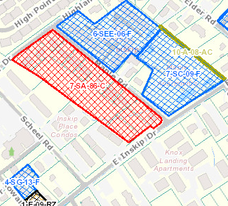
The application can be accessed at MPC Cases

Thursday, June 27, 2013/Author: Jimmy Brink/Number of views (892)/Comments (0)/ Article rating: 5.0
Categories: Public

Property Lookup HyperLink added to KGIS Maps

in Parcel Identify...Get Full Parcel Details....Results pane

A new "Property Lookup" hyperlink has been added to the Parcel Results pane of KGIS Maps, thereby integrating the interactive mapping application with the Knox County Property Assessor's new "E-Gov" Property Lookup website. The information <READ MORE>

Thursday, April 25, 2013/Author: Keith G. Stump/Number of views (11215)/Comments (0)/ Article rating: 2.4
Categories: Public

USGS Topographic Quads Image Service added

Accessible via ArcGIS Desktop and via Advanced KGIS Maps

USGS Quad Image ServiceA new USGS Topographic Quad Map image service has been created for GIS software users of KGIS.  The vintage 20' contour maps are still a great historical resource, but they are also used by the engineering departments for "blue line stream" verification for new development permits and site plans. To access the ...READ MORE...
Thursday, April 18, 2013/Author: Keith G. Stump/Number of views (176)/Comments (0)/ Article rating: No rating
Categories: Partners
123456

Theme picker