What's New

What's New or Updated

Topographic Compare Tool provides visual look at Contour products

LiDAR derived contours vs KGIS's Traditional contour product

The KGIS Staff has created a web-based Topographic Contour Comparison Tool that will provide departments with a visual look at the different types, and vintages, of contour products being considered as a replacement and/or update to KGIS's aging Topographic Map. (now approaching 8 years old for the western half of Knox County). LiDAR data is a key ingredient to the Landbase Update program of KGIS, having been used for both the 2003 topographic map update (by Merrick) and the 2007-2010 update (by Sanborn). READ MORE

Tuesday, May 19, 2015/Author: Keith G. Stump/Number of views (122)/Comments (0)/ Article rating: No rating

KGIS Maps link to Google Street View now more powerful

Google Trekker data for Trails / Greenways made available

Google continues to add new tools and data content, and its latest incorporation of virtual tours of Knoxville and Knox County trails and greenways is just the latest. Users of KGIS Maps can also take advantage of that new information by using the Google Street Map integration tool. Click Here for More...

Thursday, April 23, 2015/Author: Keith G. Stump/Number of views (2154)/Comments (0)/ Article rating: 3.0

Old Architecture Easy to Find with KGIS Maps

National Register Historic Buildings

From the Boyd Harvey House nestled deep in the southwest corner of the county to the Arnweyn House that stands a stone’s throw from the Holston River, Knox County is home to many antebellum structures, sites, and districts listed on the National Register of Historic Places. A new theme in the KGIS Maps website—powered by data compiled by MPC staff—makes finding those historic places as easy as clicking a mouse. MORE..
Wednesday, March 4, 2015/Author: Jimmy Brink/Number of views (941)/Comments (0)/ Article rating: 5.0

KGIS to start editing High-Priority Landbase Features

Landbase Feature Class Updates Coming Soon

Over the next several weeks, KGIS will version and enable archiving on the 24 landbase feature classes. This will allow us to edit the landbase data and update it based off the 2014 aerial orthophotography and subsequent years. We will capture those edits in an archive so we can look at the data changes overtime.  KGIS will start with the High-Priority Planimetry Features outlined in the Strategic Plan for Landbase Update Program . Read More.
Tuesday, November 25, 2014/Author: Chris Halcomb/Number of views (158)/Comments (0)/ Article rating: 5.0

FEMA data now updated on KGIS Maps

National Flood Hazard Layer (NFHL)
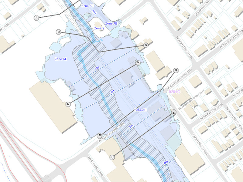
The National Flood Hazard Layer (NFHL) dataset represents the current effective flood data for Knox County.  This dataset is a compilation of effective Flood Insurance Rate Map (FIRM) databases and Letters of Map Change (LOMCs). KGIS received the data in December 2013, but upon the initial review of the dataset it had large amounts of missing data. After several months of revisions by FEMA, KGIS finally received a finished dataset. Although several database table/layer changes have occurred since the last update in 2007, we have been able to display the data using the same symbology KGIS has used for the last couple of years. Please go to KGIS Maps-->Maps--> Planning and Zoning Maps--> and Click on FEMA Flood Map or click here. READ MORE

Tuesday, May 13, 2014/Author: Chris Halcomb/Number of views (1380)/Comments (0)/ Article rating: 5.0
123456

Theme picker