What's New

What's New or Updated

QC'ing the Contours

New 2' contour data covers all of Knox and KUB areas
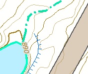
TESTING....KGIS has just received a delivery of the 2' contour data covering all of Knox County and the entire KUB service area. The dataset is HUGE! More than 17 gigs in size (as compared with our previous contour dataset size of 5 gigs). And the detail seems to reflect the very high accuracy of the LiDAR data that was flown at a 4 points per meter density back in the spring of 2016. READ MORE...


Monday, May 8, 2017/Author: Keith G. Stump/Number of views (149)/Comments (0)/ Article rating: No rating

Preliminary 2016 Aerial Theme added to KGIS Maps

Located under the Historical Aerials group

A new 2016 Aerial (Preliminary) map theme has been added to KGIS Maps. Since these aerials are preliminary, by-products of the Spring 2016 Knox County Property Assessor project with EagleView - Pictometry , they don't quite meet the product standards of past KGIS aerial products. Therefore, instead of replacing the default Aerial Theme (which is still vintage 2014), the preliminary aerials are located under the Historical Aerials category of Map themes (see image). READ MORE....

Thursday, May 26, 2016/Author: Keith G. Stump/Number of views (507)/Comments (0)/ Article rating: No rating

2016 Aerial Images now visible via KGIS Maps

Updated 360° Oblique Photos from Pictometry

Newly acquired Spring 2016 oblique, 360° aerial imagery is now accessible to the KGIS Maps audience. Acquired in the Spring of 2016 by the Knox County Property Assessor,  the EagleView - Pictometry imagery provides a fresh, updated look at our ever-changing Knoxville and Knox County landscape. (For example, Click here to compare the 2016 and 2014 images of the redesigned Fort Dickerson Park entrance.). To access the....READ MORE

Thursday, April 21, 2016/Author: Keith G. Stump/Number of views (1088)/Comments (0)/ Article rating: No rating

Changes in ArcMap Desktop access to Web Services

Especially applies to Aerial map services within Map (MXD) document

KGIS  upgraded its ArcGIS Server system this past weekend, moving to version 10.2.2 of that platform from version 10.  Because of certain architectural changes in how ArcMap interacts with map services, desktop users of ESRI's ArcGIS software may therefore experience "broken links" in the ArcMap documents (.mxd's) after the upgrade.  This mainly applies to aerial photography layers in your .mxd’s...CLICK HERE FOR MORE

Thursday, July 30, 2015/Author: Keith G. Stump/Number of views (113)/Comments (0)/ Article rating: No rating

Topographic Compare Tool provides visual look at Contour products

LiDAR derived contours vs KGIS's Traditional contour product

The KGIS Staff has created a web-based Topographic Contour Comparison Tool that will provide departments with a visual look at the different types, and vintages, of contour products being considered as a replacement and/or update to KGIS's aging Topographic Map. (now approaching 8 years old for the western half of Knox County). LiDAR data is a key ingredient to the Landbase Update program of KGIS, having been used for both the 2003 topographic map update (by Merrick) and the 2007-2010 update (by Sanborn). READ MORE

Tuesday, May 19, 2015/Author: Keith G. Stump/Number of views (96)/Comments (0)/ Article rating: No rating
123

Theme picker