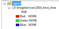
 KGIS upgraded its ArcGIS Server system this past weekend, moving to version 10.2.2 of that platform from version 10. Because of certain architectural changes in how ArcMap interacts with map services, desktop users of ESRI's ArcGIS software may therefore experience "broken links" in the ArcMap documents (.mxd's) after the upgrade. This mainly applies to aerial photography layers in your .mxd’s,
--------
since these are generally "sourced" via image service connections to ArcGIS Server. However, if any other KGIS-hosted map services have been added to the user's map document, this same issue may also apply.
Users should know there is a problem on Monday the 27th (or after) as they open a map and visually see that there are red exclamation marks (!) next to one of the photo layers, and upon realization that those items are not displaying. The fix is simple and CLICK HERE for instructions on how to repair those layers
As always, KGIS Staff will be glad to help if users need assistance, and we apologize for the inconvenience of having to do this. We encourage users to please share this information with any co-workers who also use ArcMap.