Newly acquired Spring 2016 oblique, 360° aerial imagery is now accessible to the KGIS Maps audience. Acquired in the Spring of 2016 by the Knox County Property Assessor, the EagleView - Pictometry imagery provides a fresh, updated look at our ever-changing Knoxville and Knox County landscape. (For example, Click here to compare the 2016 and 2014 images of the redesigned Fort Dickerson Park entrance.). To access the...
-----------------------------------
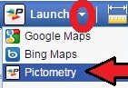
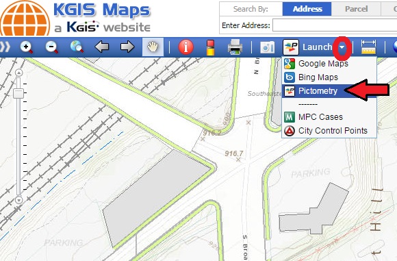
... oblique aerial imagery from KGIS Maps one will want to use the Launch drop-down tool located on the blue toolbar near the top of the screen.
Steps:
1) Navigate and/or Zoom the Map to an area of interest,
2) Then change the default option (current set to "Google Maps") of the Launch tool as follows:
- a) Select the small "down" arrow located to the right side of the Launch button (see image above)
- b) then select Pictometry from the drop down list.
3) A pop-up (yes, "pop-ups" must be allowed by your browser) should then appear showing the most recently available Oblique Aerial Photo for your selected area of interest.
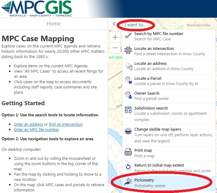
The new imagery can also be accessed via the MPC Cases web site by clicking on the I Want to...Pictometry links (see image below).