Google continues to add new tools and data content, and its latest incorporation of
virtual tours of Knoxville and Knox County trails and greenways is just the latest. Users of
KGIS Maps can also take advantage of that new information by using the
Google Street Map integration tool.
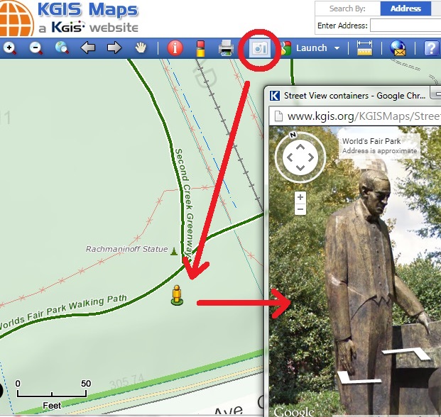
The Google Street View integration tool is located on the blue toolbar in KGIS Maps, and is depicted by a small "camera" icon.
- First, issue a left mouse click on the "camera" icon.
- Then, issue another left mouse click anywhere on the map where a trail or greenway might be found. (In the image below, the user selected a location near the Rachmaninoff Statue in the Worlds Fair Park within KGIS Maps' Neighborhood Map theme).
- A "pop up" window will then be presented to the user (Note: make sure you have enable "pop ups" in your browser) of Google Maps Street View, with access to the Google Trekker images.

The new virtual map content in Google is the result of a community-wide effort, especially led by the support of the MPC. To read more about this project, click on the News Release article found on the City of Knoxville's website