 A new USGS Topographic Quad Map image service has been created for GIS software users of KGIS. The scanned images of the vintage 20' contour maps are still a great historical resource, but they are also used by the engineering departments for "blue line stream" verification for new development permits and site plans. To access the
---------------------------------
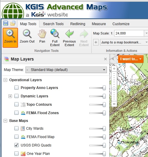
the image services via KGIS Advanced Maps, users simply need to access the Layers List (by choosing the Show Layers button on the top toolbar), and then select the USGS DRG Quads from the list. (see image below). (or click here to go straight to the USGS Quads).
Or, to access the image service via ESRI's ArcGIS Desktop software, users can perform the following steps:
1) Select
ADD DATA
2) Select the "GIS Service" to KGIS's internal map server (it should be called something like "ArcGIS Server @www.kgis.net")
3) Select
Image Server
4) Select the
USGS_DRG_Quad service (DRG = "Digital Raster Graphics")