The Atlantic Group has indicated that its
LiDAR flight acquisition, covering all of Knox County and the extended KUB service area,
was successfully completed yesterday (Monday March 7th, 2015).
----------------------------------------
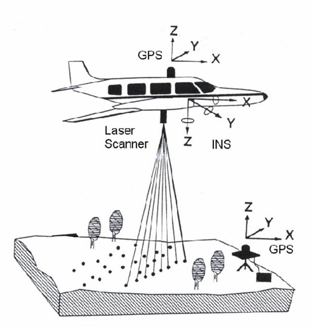
The LiDAR data is a critical component to the update of KGIS's topographic contour maps, and will also be used as a supporting base for the rectification of the aerial ortho-photography.
To view the Lidar Acquisition Status Map, Click Here
Altantic plans to acquire the aerial ortho-photography during the next week (March 15th-16th).