KGIS News

FEMA Flood Maps have been updated with modified symbology and labels

MPC has recommended some changes to the FEMA Flood zones map on the KGIS viewers. Many people, even city and county staff cannot readily interpret what they see when they turn on the FEMA layers. To view the FEMA Flood Maps on KGIS Maps click here.

Tuesday, June 2, 2015/Author: Jimmy Brink/Number of views (785)/Comments (0)/ Article rating: 3.7
Categories: Public

Old Architecture Easy to Find with KGIS Maps

National Register Historic Buildings

From the Boyd Harvey House nestled deep in the southwest corner of the county to the Arnweyn House that stands a stone’s throw from the Holston River, Knox County is home to many antebellum structures, sites, and districts listed on the National Register of Historic Places. A new theme in the KGIS Maps website—powered by data compiled by MPC staff—makes finding those historic places as easy as clicking a mouse. MORE..
Wednesday, March 4, 2015/Author: Jimmy Brink/Number of views (921)/Comments (0)/ Article rating: 5.0
Categories: Public

KGIS Maps Help has been updated with Pictometry information

KGIS has updated the KGIS Maps Help document, click here to go to the Help pdf file. Look for the Web Site Integration section of the help document and then scroll down to the Pictometry Viewer section. If you are using KGIS Maps click on the Help icon  to get to the pdf file.

Tuesday, July 22, 2014/Author: Jimmy Brink/Number of views (996)/Comments (0)/ Article rating: 1.0
Categories: Public

KGIS has switched back to the 2010 Aerials as the default Aerial map theme.

Because of problems caching the 2013 Aerial imagery KGIS has switched back to the 2010 Aerial as the default Aerial map theme. If you want to switch to the 2013 Aerial you can change map theme by clicking on the Maps tab, next click on Historical Aerials drop-down arrow to the right of the word Historical Aerials, then click on the circle to the left of 2013 Aerial. (For more info click here.)

Tuesday, January 14, 2014/Author: Jimmy Brink/Number of views (1084)/Comments (0)/ Article rating: No rating
Categories: Public

New 2013 Aerial Imagery added to KGIS Maps

The 2013 Aerial Imagery from USGS has been added to KGIS Maps Aerial map theme. To view click on the Maps tab left of the map, next click on the Aerial map theme under Standard Map. For metadata on the 2013 USGS Aerial Imagery click here. For more information, Click Here.

Saturday, October 26, 2013/Author: Jimmy Brink/Number of views (1744)/Comments (0)/ Article rating: 2.5
Categories: Public

MPC & TDOT Traffic data has been updated.

Traffic Counts updated to show 2012 data

MPC & TDOT Traffic data has been updated with traffic counts for 2012 on the KGIS Maps Internet mapping site, click on the Maps tab, under Other Maps click on Traffic Counts theme.  MPC and TDOT traffic data information will display as you zoom in on the traffic station points. Click here to load map.
Tuesday, July 23, 2013/Author: Jimmy Brink/Number of views (859)/Comments (0)/ Article rating: No rating
Categories: Public

MPC Case Mapping Viewer Launched

A collaborative effort between KGIS and the Metropolitan Planning Commission has culminated in the release of a updated web-mapping application providing access to both current MPC agenda items as well as nearly 18,000 historic MPC Cases, along with related information, dating back to the early 1980’s.

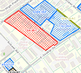
The application can be accessed at MPC Cases

Thursday, June 27, 2013/Author: Jimmy Brink/Number of views (850)/Comments (0)/ Article rating: 5.0
Categories: Public

Theme picker