BLynn

EasyDNNNews

Changes in ArcMap Desktop access to Web Services

Especially applies to Aerial map services within Map (MXD) document

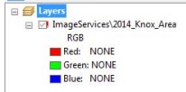
KGIS  upgraded its ArcGIS Server system this past weekend, moving to version 10.2.2 of that platform from version 10.  Because of certain architectural changes in how ArcMap interacts with map services, desktop users of ESRI's ArcGIS software may therefore experience "broken links" in the ArcMap documents (.mxd's) after the upgrade.  This mainly applies to aerial photography layers in your .mxd’s...CLICK HERE FOR MORE

Thursday, July 30, 2015/Author: Keith G. Stump/Number of views (319)/Comments (0)/ Article rating: No rating

Mark Antonik to be KGIS's new ESRI Account Manager

replaces Scott Wolter

KGIS has received notice that Mark Antonik will replace Scott Wolter as the ESRI account executive. Mark has been with ESRI for the past 3 years working with County & City Government and will be covering County accounts across North Carolina, South Carolina & Tennessee. He has provided the following contact information and CLICK HERE FOR MORE...

Tuesday, July 21, 2015/Author: Keith G. Stump/Number of views (303)/Comments (0)/ Article rating: No rating

Topographic Compare Tool provides visual look at Contour products

LiDAR derived contours vs KGIS's Traditional contour product

The KGIS Staff has created a web-based Topographic Contour Comparison Tool that will provide departments with a visual look at the different types, and vintages, of contour products being considered as a replacement and/or update to KGIS's aging Topographic Map. (now approaching 8 years old for the western half of Knox County). LiDAR data is a key ingredient to the Landbase Update program of KGIS, having been used for both the 2003 topographic map update (by Merrick) and the 2007-2010 update (by Sanborn). READ MORE

Tuesday, May 19, 2015/Author: Keith G. Stump/Number of views (199)/Comments (0)/ Article rating: No rating

KGIS Maps link to Google Street View now more powerful

Google Trekker data for Trails / Greenways made available

Google continues to add new tools and data content, and its latest incorporation of virtual tours of Knoxville and Knox County trails and greenways is just the latest. Users of KGIS Maps can also take advantage of that new information by using the Google Street Map integration tool. Click Here for More...

Thursday, April 23, 2015/Author: Keith G. Stump/Number of views (2315)/Comments (0)/ Article rating: 3.0

LiDAR Aerial Mission has been Suspended

Pictometry unable to complete mission prior to "leaf-on" conditions

Unfortunately, Pictometry's project manager, Jim Kanaley, has informed KGIS staff that its LiDAR mission on behalf of KGIS and KUB is still only 70% complete as of today, April 14, 2015. Therefore, considering the high level of "leaf-on" conditions, which adversely affect the accuracy of the end product, KGIS has called for a suspension to the project. The LiDAR mission had called for flying all of Knox County and KUB's service area outside of Knox County at a precision to support generation of 2 foot contours. Read More...
Tuesday, April 14, 2015/Author: Keith G. Stump/Number of views (189)/Comments (0)/ Article rating: No rating
124678910Last

Theme picker