BLynn

EasyDNNNews

LiDAR data now "in-house" and being Reviewed

Spring 2014 flight by Pictometry/EagleVision
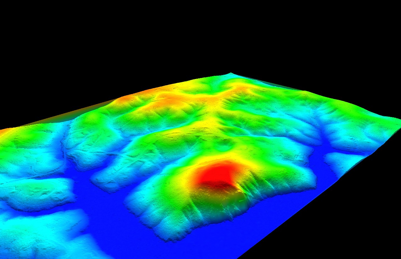
The initial delivery of the Spring 2014 LiDAR data covering all of Knox County (along with portions of Union, Grainger, Jefferson and Sevier) has been received from Pictometry / EagleVision. The LiDAR data is the first, and most important component, to KGIS's topographic base map program, and is increasingly being used by our local government and utilties (Link). KGIS's initial review of the LiDAR data has uncovered some technical issues that will most likely result in the need for re-delivery. If you wish to gain access to the data prior to its acceptance or review, please contact Chris Halcomb here at KGIS.

Thursday, May 8, 2014/Author: Keith G. Stump/Number of views (87)/Comments (0)/ Article rating: No rating
Categories: KGIS DeptsPartners

Presentation about the Landbase Program

provided to Coordinating Committee on March 11, 2014

In conjunction with Keith's proposed FY 2015 Budget, he also presented the Coordinating Committee with an overview of the Landbase / Aerial Photography program and its current status. He highlighted how the Policy Board had already approved of acting on several of the recommendations that came out of the User Needs Analysis; and he also made recommendations regarding the long-range and next steps towards maintaining an up-to-date suite of landbase products. Click here to review the slides; or visit the Projects...Landbase page for other related items.

Friday, March 14, 2014/Author: Keith G. Stump/Number of views (90)/Comments (0)/ Article rating: No rating
Categories: KGIS Depts

Online Survey Results reveal varied use of KGIS

Addresses and Property Ownership tagged as most important features

More than 200 individuals took part in an online survey conducted on KGIS's behalf back in November 2013, and the results show a varied use of the KGIS applications and  geospatial data. We want to thank everyone who participated in that survey, and are always open to hearing from folks on how we might do things better. Click here to review the Survey Results, and click here to send us an email with your suggestions and comments.


Thursday, February 20, 2014/Author: Keith G. Stump/Number of views (1040)/Comments (0)/ Article rating: No rating
Categories: Public

Results of User Needs Analysis presented to Executive Subcommittee

Submitted by Plangraphics in November 2013

Plangraphics issued a set of eleven primary recommendations to the User Needs Analysis subcommittee in November 2013. The results included an Executive Summary document, a PowerPoint Presentation, and a set of supporting documents that were compiled by Plangraphics as part of its data gathering task. The results of an online survey (conducted via Survey Monkey) were also presented. The  Coordinating Committee's Executive Team plans to share the results of this user needs analysis at the next Policy Board Meeting... READ MORE 
Friday, January 31, 2014/Author: Keith G. Stump/Number of views (6693)/Comments (0)/ Article rating: No rating
Categories: KGIS Depts

Aerial Mission Status: "Wait for the Melt"

Pictometry planes on site and ready for deployment

KGIS has received word from Pictometry, Inc. that the airplanes are on site, and ready to pursue the aerial photography mission on behalf of the County Property Assessor and KGIS. The flight crew delivered the message “Warmer weather head, we’ll wait for the melt.”  The aerial services contract calls for the aerials to be available for viewing by KGIS within 30-60 days from acquisition. Click Here to view some photos of their scouting mission.

Friday, January 31, 2014/Author: Keith G. Stump/Number of views (116)/Comments (0)/ Article rating: No rating
Categories: KGIS Depts
123468910Last

Theme picker