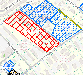
A collaborative effort between KGIS and the Metropolitan Planning Commission has culminated in the release of a updated web-mapping application providing access to both current MPC agenda items as well as nearly 18,000 historic MPC Cases, along with related information, dating back to the early 1980’s.
The application can be accessed at http://www.kgis.org/mpccases
Using a map, the application allows users to locate within the city or county and see the history of MPC reviews including rezonings, plan amendments, use on reviews and subdivisions that have occurred there.
Access to MPC actions is important to developers, surveyors, engineers and the public who may be seeking to improve a property or to simply retrieve information about the approval process for a property and any conditions that may apply.
The new offering replaces an earlier version of the application launched in 2009. Sluggish performance and end of support for the initial platform led MPC to seek a new solution.
After consulting with both internal KGIS users and seeking public comment, the overwhelming response was that functionality of the application should be preserved, but focus on support for additional browsers and devices should be included.
The new application supports PC’s and Mac’s running recent browser versions, as well as support for tablets and smart phones.