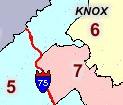
 The realigned State of Tennessee Senate and House districts maps have been updated on KNOXnetWhere, KGIS's interactive mapping site. The boundaries were realigned based
  upon the 2010 Census data, and are administered on the KGIS by the Knoxville MPC.
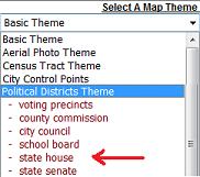
To view the boundaries, just click on the "Select a Map Theme" drop down box in the upper right corner of the KNOXnetWhere application; then select either the State Senate or State House options from the Political Districts Theme.